
Table of Contents
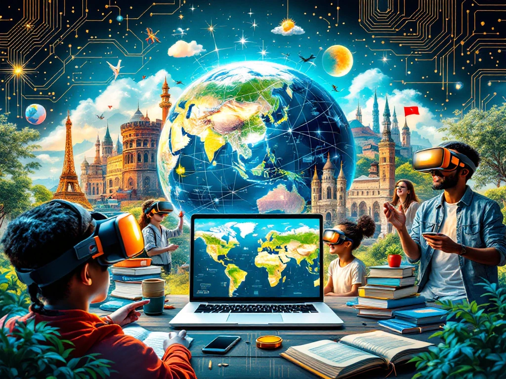
Exploring the World with Google Earth: How Does It Work?
Uncovering Google Earth’s Best Features: From Street View to Ocean Depths
Harnessing Google Earth for Personal and Business Use: Practical Tips
The Future of Google Earth: What’s Next in Digital Mapping?
Exploring the World with Google Earth: How Does It Work?
Imagine having the planet at your fingertips, ready to explore from every angle. Google Earth makes this a reality with its impressive combination of satellite imagery, 3D terrain, and geospatial data. Think of it as a digital globe that you can spin, zoom, and navigate to your heart’s content. Whether you’re charting a course using GPS navigation or immersing yourself in a virtual travel experience, Google Earth has you covered.
Its intricate layers of data come from a variety of sources, including satellite pictures, aerial views, and government databases. These create an incredibly detailed and interactive map of our world. You can zoom in to view your house or pan out to see the continents. Beyond that, the Earth Explorer function allows users to dig into specific areas of interest, providing insights into everything from street-level views to topographic maps.
What sets Google Earth apart is its ability to show changes over time. Thanks to its historical imagery feature, we can turn back the clock and witness the evolution of landscapes and cities. This gives a truly dynamic perspective, helping us appreciate the world’s ever-changing face. Whether you’re an aspiring geographer or simply curious about our planet, Google Earth transforms the way we explore the world.
Uncovering Google Earth’s Best Features: From Street View to Ocean Depths
Google Earth is packed with features that turn a simple map into an immersive exploration tool. One of its most loved features is Street View, which allows us to virtually walk down streets from anywhere on the globe. It’s like having your very own teleportation device! This feature provides 360-degree panoramas, making it easy to familiarize yourself with far-off locations or just explore neighborhoods around the world.
But the magic doesn’t stop at street level. Google Earth’s Voyager tool takes us on guided tours curated by experts like BBC Earth and NASA, blending fascinating stories with stunning geographical insights. Whether it’s uncovering ancient ruins or learning about climate change, these tours educate and enchant in equal measure.
For those intrigued by the mysteries of the deep, the Ocean View mode is a revelation. Dive beneath the waves to explore underwater landscapes in 3D, complete with shipwrecks and coral reefs. It’s a great way to experience marine environments without getting wet.
Unique to Google Earth is the flight simulator mode, where users can soar above the earth, offering a pilot’s perspective from their computer screens. It’s an exhilarating way to gain a bird’s-eye view of the planet’s geography, turning the globe into an interactive canvas for learning and exploration.
Harnessing Google Earth for Personal and Business Use: Practical Tips
Google Earth’s versatility extends far beyond virtual sightseeing. For personal use, it’s a fantastic tool for planning road trips, finding hiking trails, or simply exploring potential travel destinations. The terrain view offers elevation details, perfect for those who love adventure sports or photography, helping you pick the best scenic spots for your next trip.
Businesses, too, can leverage Google Earth’s powerful features. It’s invaluable for real estate professionals, who can provide clients with detailed views of neighborhoods and properties. Businesses involved in logistics can use it for route planning and optimizing deliveries. The satellite imagery and 3D mapping capabilities enable detailed site analysis, useful in fields like construction and agriculture.
With Google Earth Pro, companies can access high-resolution images and create detailed map overlays, incorporating custom data into their projects. This feature is particularly useful for geospatial analysts and urban planners, who rely on precise geospatial data for informed decision-making.
Moreover, Google Earth can be an educational powerhouse. Teachers can engage students with interactive lessons on geography, history, and environmental science. By navigating different terrains and exploring historical imagery, students experience a dynamic learning environment that’s both informative and exciting.
Whether for leisure or professional purposes, Google Earth serves as a bridge to a wider understanding of our planet, offering endless opportunities for discovery and innovation.
The Future of Google Earth: What’s Next in Digital Mapping?
As technology evolves, so does Google Earth, pushing the boundaries of what digital mapping can achieve. The future promises even more interactive and immersive experiences. With advancements in geospatial technology and artificial intelligence, Google Earth could become even more intuitive, providing real-time data and experiences that are close to reality.
Imagine augmented reality integrations in Google Earth, where digital elements overlay the physical world, offering interactive travel guides as you move through cities or natural landscapes. Such innovations could transform how we perceive mapping, turning it into a comprehensive guide that can adapt to our preferences and needs.
The potential for further integration with AI also opens up exciting possibilities. Picture a virtual assistant that provides custom tour suggestions based on our past interests or helps analyze geographic trends for businesses. This personalized approach could make Google Earth an even more indispensable tool for travelers, educators, and businesses.
Moreover, the increased availability of high-resolution satellite imagery will enhance accuracy, offering users a clearer and more detailed view of the world. As Google continues to update and refine its mapping technologies, the future of Google Earth appears both promising and dynamic, poised to revolutionize how we explore, learn, and interact with our planet.
Conclusion
Google Earth is more than just a map—it’s a gateway to the world, offering a unique blend of exploration, education, and practical applications. From personal adventures in virtual travel to professional uses in business and education, its capabilities are vast and varied. As we look to the future, advancements in technology promise to make these experiences even more immersive and interactive. Whether you’re planning your next trip, learning about different cultures, or conducting business analysis, Google Earth provides the tools to broaden our horizons and deepen our understanding of the world. Embrace its potential, and see where this extraordinary platform can take you.
FAQs
Q: Is Google Earth free to use?
A: Yes, Google Earth is free for personal use. There is also a version called Google Earth Pro, which offers additional features like high-resolution stitching for prints and is also free to download.
Q: Can I use Google Earth offline?
A: Google Earth requires an internet connection to stream map data. However, with Google Earth Pro, you can download parts of maps for offline use, which is useful for areas with limited connectivity.
Q: How often is Google Earth updated?
A: Google Earth’s satellite images are updated regularly, but not in real-time. The frequency of updates varies based on the area’s population density and importance, with major cities updated more frequently than rural areas.
What is next?
Ready to explore all that Google Earth has to offer? Dive into a world of discovery and let your curiosity guide you. Whether you’re a seasoned explorer or just getting started, there’s always something new to learn and experience. For personalized guidance or to enhance your use of Google Earth for specific projects, feel free to reach out. Call us on 989789686756 to speak with our experts, who can help tailor the platform to meet your unique needs, and start uncovering the endless possibilities that await. The world is at your fingertips, and your next adventure is just a click away!